Key Points
- First Seasonal Cold Front: South Florida and the Treasure Coast are preparing for the first significant cold front of the autumn season, bringing a dramatic drop in temperature and humidity after months of warm conditions.
- Temperature Drop Breakdown: Daytime highs currently remaining in the mid-80s Fahrenheit will drop into the 70s by Friday, with daytime temperatures over the weekend struggling to exceed the upper 60s in coastal areas.
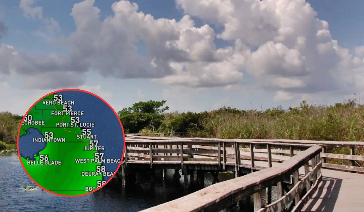
- Chilly Morning Lows: Overnight and morning temperatures are forecast to fall into the 50s and 60s Fahrenheit across the region by Saturday morning, marking the lowest temperatures recorded in the area since March 2026.
- Preceding Shower and Flood Risk: Increased moisture ahead of the frontal boundary will bring scattered showers and isolated downpours on Wednesday and Thursday, posing localized flooding risks to areas with standing water.
- Broad Synoptic Impact: The cold front is linked to a major national weather pattern expected to develop into a powerful nor’easter, threatening the Northeastern United States with early-season snowfall.
West Palm Beach(Florida Report Daily) November 10, 2026 – Executive Summary: South Florida meteorologists have confirmed that the region’s first major cold front of the autumn season is scheduled to cross the peninsula late this week. After extended periods of warm and muggy conditions, daytime high temperatures will fall into the 70s and 60s Fahrenheit over the weekend, accompanied by a sharp decline in dew points and relative humidity. Overnight lows on Saturday morning will drop into the 50s across several inland and coastal communities. Preceding the frontal passage, scattered showers on Wednesday and Thursday could produce localized flooding in low-lying areas.
- Key Points
- What Temperatures Are Expected Across Florida After the Cold Front Arrives?
- How Will Humidity Levels Change Following the Pass of the Frontal Boundary?
- What Rainfall and Flooding Risks Precede the Arrival of the Cold Air?
- Why Could the Northeastern United States Experience Early-Season Snowfall?
- Background of the Particular Development
- Prediction: How This Development Can Affect Residents, Local Agriculture, and Tourism
South Florida is set to experience its first true autumn cool-down of the year as a potent cold front approaches the region, ending months of high heat and humidity. The weather system will push daytime high temperatures from the mid-80s down into the 70s on Friday, with coastal areas along the Treasure Coast seeing highs remain in the 60s by Saturday. Overnight lows will drop into the 50s and 60s, delivering the region’s lowest temperatures since March 2026. Ahead of the cold air mass, scattered showers and isolated heavy downpours will affect South Florida on Wednesday and Thursday, raising concerns for localized standing water flooding before drier air moves in.
What Temperatures Are Expected Across Florida After the Cold Front Arrives?
As reported by digital reporter Lauren Olesky of CBS12 Weather, South Florida residents will experience a pronounced thermal transition as daytime temperatures shift from persistent mid-80s down into the 70s starting Friday.
As detailed by Lauren Olesky of CBS12 Weather, the cooling trend will intensify by Saturday morning, when daytime high temperatures across several coastal locations—particularly along the Treasure Coast—may struggle to break out of the 60s Fahrenheit.
Regarding overnight conditions, Lauren Olesky of CBS12 Weather stated that morning low temperatures will drop sharply into the 50s and 60s Fahrenheit across the region by Saturday morning.
Meteorological records indicate that the region has not experienced temperatures this low since March 2026.
How Will Humidity Levels Change Following the Pass of the Frontal Boundary?
As reported by Lauren Olesky of CBS12 Weather, high atmospheric moisture levels will remain elevated throughout the midweek period across the Palm Beaches and the Treasure Coast. Dew point readings in the mid-to-upper 60s will sustain muggy and humid surface conditions through Thursday.
However, as outlined by Lauren Olesky of CBS12 Weather, the passage of the cold front late Thursday into Friday morning will usher in a continental air mass, causing surface dew points to collapse.
The arrival of drier air will clear out atmospheric moisture, resulting in significantly lower humidity, crisp breezes, and clear conditions throughout the upcoming weekend.
What Rainfall and Flooding Risks Precede the Arrival of the Cold Air?
As reported by digital reporter Lauren Olesky of CBS12 Weather, the transition to cooler weather will be preceded by unsettled atmospheric conditions and widespread cloud cover.
As detailed by Lauren Olesky of CBS12 Weather, rain chances will elevate significantly across Wednesday and Thursday as the frontal system approaches from the north. The system is forecast to trigger scattered light showers and isolated heavy downpours across coastal and inland counties.
While total accumulated rainfall is expected to remain scattered, Lauren Olesky of CBS12 Weather emphasized that localized flooding could present challenges for communities still dealing with standing water and saturated ground from prior weather events.
Why Could the Northeastern United States Experience Early-Season Snowfall?
As reported by Lauren Olesky of CBS12 Weather, the cold front impacting Florida forms part of a much larger, continent-wide synoptic weather pattern moving across the eastern half of the United States.
While the southern trailing edge of the system delivers cooler air and low humidity to the Gulf Coast and Florida peninsula, the northern core of the trough is projected to interact with Atlantic moisture.
According to meteorological analyses cited by CBS12 Weather, the system is expected to intensify into a classic nor’easter as it tracks north-northeastward along the US East Coast, potentially producing early-season snowfall and strong coastal winds across parts of the Northeastern United States.
Background of the Particular Development
Seasonal weather patterns in Florida are dictated by the southward migration of the jet stream during the autumn months. Throughout late spring, summer, and early autumn, the Florida peninsula is dominated by maritime tropical air masses originating from the Caribbean Sea and the Gulf of Mexico, maintaining persistent high temperatures in the upper 80s to 90s alongside high relative humidity.
Typically, South Florida receives its first continental cold front between late October and mid-November. These frontal boundaries originate over northern continental landmasses and are pushed southward by high-pressure systems building behind cold low-pressure troughs.
The passage of the first major front of the 2026 autumn season marks the official meteorological transition out of the summer-like regime into Florida’s dry season, which generally extends through late April. The reduction in sea surface temperatures and atmospheric moisture also effectively curtails tropical weather development across the immediate coastal waters of the state.
Prediction: How This Development Can Affect Residents, Local Agriculture, and Tourism
The arrival of the first seasonal cold front will trigger broad operational shifts across agricultural, municipal, and commercial sectors in Florida.
Impact on Local Residents and Energy Consumption
For residents across Palm Beach, Martin, St. Lucie, and Indian River counties, the sudden drop in temperature and humidity will bring relief from summer cooling demands. Local utility providers generally observe a measurable drop in grid demand during the first cold front of the season as households turn off central air conditioning units and open windows for natural ventilation. However, vulnerable populations—including the elderly and unhoused individuals—will require community resources to manage overnight drops into the 50s.
Impact on Agriculture and Outdoor Commercial Operations
For agricultural producers along the Treasure Coast and Lake Okeechobee regions, the front brings both benefits and operational considerations. The drop in atmospheric humidity reduces fungal disease pressures on winter vegetable crops and citrus groves. However, citrus growers and nursery operators will closely monitor soil moisture levels ahead of the wind shift to prevent crop desiccation. Outdoor hospitality providers, coastal marine businesses, and charter boating operations will face temporary disruptions on Wednesday and Thursday due to pre-frontal showers before benefiting from favorable weekend recreation weather.
Impact on Regional Tourism and Seasonal Visitors
The seasonal cool-down historically accelerates the arrival of seasonal residents (“snowbirds”) and autumn tourists traveling from northern states to Florida. Concurrently, the formation of the associated nor’easter in the Northeast could cause widespread commercial aviation delays and flight cancellations at major transit hubs such as New York (JFK/LGA/EWR) and Boston (BOS), indirectly affecting travel timelines into West Palm Beach International Airport (PBI) and Fort Lauderdale-Hollywood International Airport (FLL) over the weekend.