US weather station colder than the Arctic

Temperatures in parts of the US are the coldest on the planet when wind chill factors are added in, with -73C (-100F) being predicted for one spot in New Hampshire.
The 1,916m-high Mount Washington, a ski resort in the White Mountain National Forest, was forecast to be the coldest spot in the US, according to the weather observation station located on its summit.
On Saturday, it had fallen to -38C (-37F), with a wind chill equivalent of -69C (-93F), tying it with Armstrong, Ontario, in Canada, as having the lowest temperature in the world.
The coldest air temperature was recorded at -39C (-38F) in Eureka, Nunavut, in Canada and Jakutsk, Russia, but those places are not thought to have had low wind chills.
Other New England locations also saw record lows.
Burlington, Vermont, was -18.3C (-1F) and -34.4C (-30F) with wind chill; and Hartford, Connecticut, was -12.2C (10F) and -29C (-20F) with wind chill.
The north eastern cities of Philadelphia and New York went down to -13.3C (8F) and Boston was a relatively balmy -12C (10F).
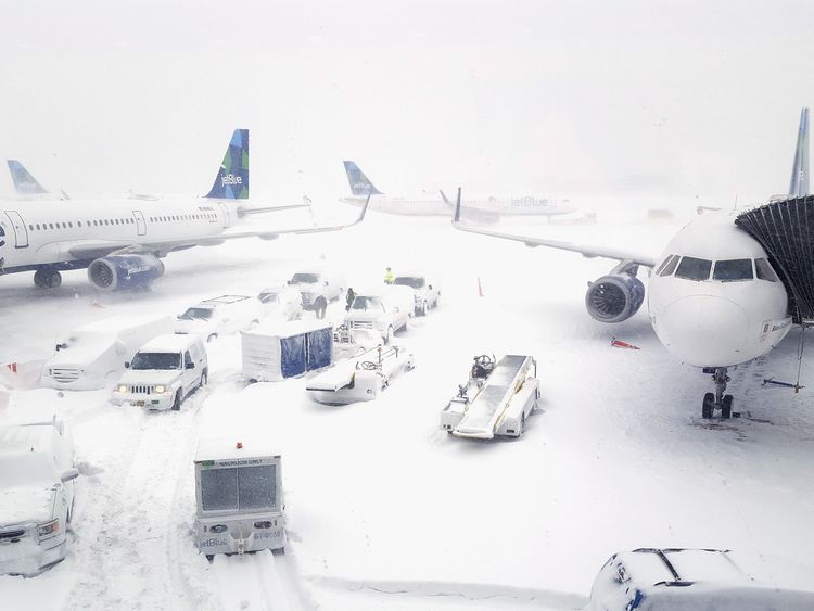
Airports have been struggling to cope with a backlog of flights, as the record-breaking temperatures have frozen parts of the US and Canada.

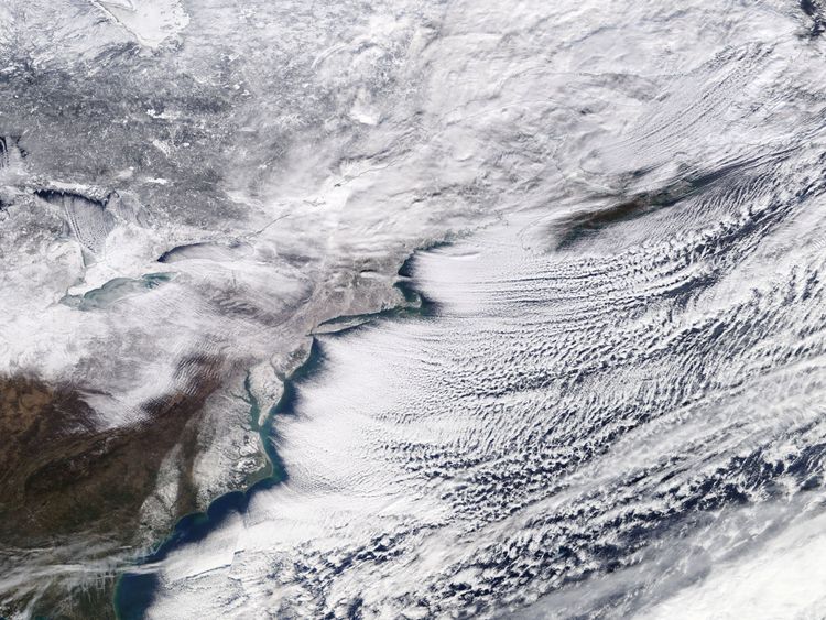
The region is in the grip of an Arctic blast with a storm that has brought snow, hurricane-force winds and coastal flooding.
Temperatures in many places have been so cold that authorities have warned residents that they risk frostbite if their skin is exposed for just 10 minutes.
The weather has also caused chaos at some of the region's airports, with more than 3,420 flights (within, into or out of the US) delayed on Saturday.

One of the worst-affected was New York's John F Kennedy Airport, which struggled to cope with the backlog of planes and passengers.
People on an Air China flight from Beijing had to wait on the tarmac for seven hours before being allocated a gate, according to a tweet from flight tracking site Flightradar24.
Been stuck on tarmac for over 3 hours at JFK Alitalia flight 8604. Multiple passengers seeking medical attention. Staff not communicating. Babies literally crying from hunger and people calling police from the plane. Please RT to get this to the press.
— Chris Mendez (@thechrismendez) January 6, 2018
Chris Mendez, a passenger on an Alitalia flight, tweeted that he and his fellow passengers had been waiting on the tarmac for "over three hours", adding: "Multiple passengers seeking medical attention… babies literally crying from hunger and people calling police from the plane."
Some flights did not even try to get that far – at least two (from Vienna and Frankfurt) turned back over the UK and Ireland due to the problems at JFK, according to FlightRadar24. A flight from Moscow turned back over Iceland and other flights diverted to other US airports.
At least 12 international flights are currently waiting for a gate at JFK airport (about 2-4h queue).
Apart from that there are 70+ aircraft at JFK airport that have been parked between 6 and 48h – probably waiting for a crew. pic.twitter.com/rNqTHmRpgq
— Flightradar24 (@flightradar24) January 6, 2018
The Port Authority, which runs New York's airports, said it was "working diligently with the FAA, airlines and individual terminal operators to limit the arrival of flights into JFK Airport until there are adequate gates available to handle the backlog of flights, due to recovery of flights schedules after Thursday's storm".
Later it said that flights were being limited into JFK for the rest of the evening, adding that the surge in flights rescheduled after the storm had combined with the weather-related damage to equipment to delay passengers and flights.
The storm began in the Gulf of Mexico last week and closed schools and businesses; suspended travel; and resulted in power cuts for many.
Winds of up to 70mph hit, while some parts saw as much as 18in (46cm) of snow.
Southeast Georgia saw a rare half foot of snow and iguanas in South Florida were left so lethargic that they fell from trees.
At least 19 people have died in the US alone, many of them due to weather-related vehicle crashes.
@JFKairport@AirChinaNA WHAT IS GOING ON?! Why are people still sitting on this plane after 6 hrs on the tarmac?! What is being done to get everyone off?! This is insane! I’ve been on this aircraft for over 20 hours now on a 14 hr flight!
— Bruno's Mind (@Brunosmind) January 6, 2018
The freeze is expected to extend into next week, according to the US National Weather Service.
Dan Hofmann, a meteorologist with the National Weather Service in Baltimore, said that the last time such extreme weather was seen was in February 2015, adding: "It's definitely cold and the type of bone-chilling cold that happens every few years."
More from Canada
Freezing rain is expected from Kansas to Tennessee; the Midwest and Northeast of the US are likely to see temperatures 20 to 30 degrees (F) below average.
Meanwhile, records are also being broken on the other side of the world – Sydney, Australia, had its hottest day in nearly 80 years: 47.3C (117F) on Sunday afternoon local time.
[contf] [contfnew] 
Sky News
[contfnewc] [contfnewc]


