Key Points
- Florida is experiencing its second major rainfall and flooding event of November 2026, with isolated areas from Indian River County to Volusia County forecast to receive more than 15 inches of rain through Friday, 20 November, according to the National Weather Service (NWS) in Melbourne.
- The National Hurricane Center (NHC) is monitoring an area of disturbed weather offshore of the southeastern United States coast with a medium chance of strengthening into a subtropical or tropical storm as it moves northward or northeastward through the weekend.
- Meteorologist Matt Lanza of The Eyewall reported that the offshore system has already drawn deep tropical moisture from hundreds of miles out in the Atlantic across Florida, warning that slow-moving, torrential downpours will cause a higher-end rainfall and flooding event.
- On 17 November, the Florida Division of Emergency Management (FDEM) warned of a “considerable to potentially catastrophic rainfall event” expected across the Florida East Coast through Saturday, 21 November, alongside flash flooding, riverine flooding, and life-threatening rip currents.
- In South Florida, Fort Lauderdale recorded 15.18 inches of rain for the month—surpassing its previous November record of 14.60 inches set in 1994—while Broward and Miami-Dade county public schools closed on Thursday, 19 November, due to severe street flooding and stranded vehicles.
- Flood watches, flood warnings, flood advisories, and flash flood warnings remain in effect across multiple east coast and central Florida counties, while the St. Johns River near Cocoa remains in major flood stage above 17 feet.
Tallahassee (Florida Report Daily) November 19, 2026 – Florida is enduring its second severe rainfall and flooding event of November 2026 as slow-moving storms inundate the state’s Atlantic coast while the National Hurricane Center tracks an offshore disturbance carrying a medium chance of subtropical or tropical storm development. Forecasters at the National Weather Service in Melbourne project more than 15 inches of rain in isolated areas between Indian River and Volusia counties through Friday, 20 November, prompting widespread flood alerts, event cancellations, and school closures across Miami-Dade and Broward counties on Thursday, 19 November.
- Key Points
- What Is Causing the Heavy Rain and Flooding Across Florida?
- What Warnings Have Florida Emergency Officials and Forecasters Issued?
- How Have Rainfall Totals, Schools, and Infrastructure Been Affected?
- What Is the Background Behind Florida’s November 2026 Flooding?
- How Could These Developments Affect Florida Residents, Commuters, and Coastal Communities?
What Is Causing the Heavy Rain and Flooding Across Florida?
Meteorological agencies and weather analysts report that Florida’s ongoing deluge is being driven by persistent, slow-moving rainbands fed by deep tropical moisture drawn westward from the Atlantic Ocean. As reported by Cheryl McCloud of the USA TODAY NETWORK – Florida, the National Weather Service office in Melbourne indicated that isolated areas stretching from Indian River County northward to Volusia County could receive more than 15 inches of rainfall through Friday, 20 November 2026.
Simultaneously, the National Hurricane Center (NHC) in Miami is tracking a broad area of disorganized showers and thunderstorms situated near the northwestern Bahamas and offshore of the southeastern United States coast. According to the NHC’s Tropical Weather Outlook issued at 7:00 a.m. EST on Thursday, 19 November 2026, the disturbance holds a medium chance of organizing into a subtropical or tropical storm while moving northward or northeastward near or just offshore of the southeastern U.S. coast through the weekend. Regardless of whether the disturbance achieves formal cyclone classification, the NHC cautioned that strong winds, dangerous surf, and coastal hazards will continue to affect the region.
What Did Meteorologist Matt Lanza Say About the Storm System?
According to meteorologist Matt Lanza, writing on The Eyewall and cited by Cheryl McCloud of USA TODAY NETWORK – Florida, the offshore disturbance has already exerted a direct meteorological impact on the Florida peninsula by pulling abundant moisture across the state from hundreds of miles out in the Atlantic Ocean.
Quoting Matt Lanza’s assessment on The Eyewall, the meteorologist stated: “Rains have potential to be quite torrential in spots and slow moving, so this is a relatively higher end rain and flooding event for Florida, even by Florida’s normally high standards for these things”. Lanza added that Florida will get “whacked by heavy rainfall” as tropical development odds increase off the East Coast in late November.
What Warnings Have Florida Emergency Officials and Forecasters Issued?
State emergency management officials and regional National Weather Service offices have maintained elevated flood and marine alerts across central, northeast, and south Florida throughout the week. As reported by Cheryl McCloud of USA TODAY NETWORK – Florida, the Florida Division of Emergency Management (FDEM) issued a statewide weather outlook on 17 November 2026 stating: “A considerable to potentially catastrophic rainfall event is expected across the Florida East Coast through Saturday (Nov. 21)”.
In its five-day statewide outlook bulletin, FDEM further identified flash flooding and riverine flooding as significant hazards, alongside dangerous and life-threatening rip currents and minor beach erosion along Atlantic beaches through Saturday, 21 November. Flood watches, flood warnings, flood advisories, and localized flash flood warnings are active across wide portions of the peninsula. Specifically, the National Weather Service placed nine counties—stretching from Volusia and Orange counties southward to Martin County—under a Flood Watch through 7:00 p.m. EST on Friday, 20 November, forecasting widespread totals of 3 to 6 inches and localized accumulations of 8 to 12 inches or more near the coast.
How Have Rainfall Totals, Schools, and Infrastructure Been Affected?
The multi-day downpours have shattered monthly precipitation records in South Florida and forced widespread disruptions to education, transportation, and municipal operations.
Record Rainfall in South Florida
According to data from the FOX Forecast Center reported by FOX Weather, Fort Lauderdale recorded an additional 4.38 inches of rainfall during the latest round of storms, pushing its cumulative November 2026 precipitation total to 15.18 inches. That figure surpasses Fort Lauderdale’s previous all-time November rainfall record of 14.60 inches established in 1994, based on meteorological records dating back to 1912, and represents more than four times the city’s historical November average of 3.69 inches. Elsewhere in Broward County, Fort Lauderdale-Hollywood International Airport set a daily rainfall record of 5.72 inches, while 24-hour rainfall estimates reached 12 to 13 inches across Hollywood, Davie, Dania Beach, and Plantation.
School Closures and Municipal Disruptions
In response to inundated roadways and forecasts of additional torrential rain, multiple school districts and local governments suspended operations. As reported by CBS News Miami, Miami-Dade County Public Schools closed all schools and district offices on Thursday, 19 November 2026, following an emergency school board meeting on Wednesday afternoon. Broward County Public Schools also kept all campuses and district offices closed on Thursday, 19 November, for a second consecutive day after nearly 12 inches of rain flooded streets, stranded vehicles, and entered homes in communities such as Miami Gardens, Plantation, and Hollywood. Earlier in the week, St. Lucie County schools also closed on Wednesday, 18 November, while Palm Beach County cancelled after-school activities and athletic events.
In Broward County, County Administrator Monica Cepero signed a local state of emergency, closing county government offices, libraries, and parks, while West Palm Beach Mayor Keith James extended his city’s Declaration of a Local State of Emergency through Sunday, 22 November 2026. In Hollywood, fire and police officials responded just before 7:00 a.m. on Wednesday, 18 November, to a roof collapse caused by heavy rainwater accumulation at Temple Sinai of Hollywood on North 46th Avenue; authorities confirmed no injuries occurred. Flooding also temporarily closed lanes along Interstate 95 and Florida’s Turnpike.
What Is the Background Behind Florida’s November 2026 Flooding?
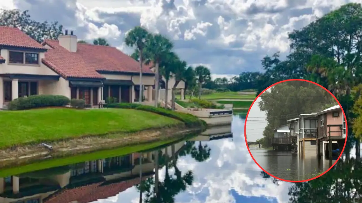
The current storms strike a region whose soils, drainage canals, and river basins were already heavily saturated by a historic rainfall event earlier in the month. Between Sunday, 1 November, and Monday, 2 November 2026, a stalled weather pattern dumped between 13 and 24.1 inches of rain across Brevard, Indian River, and St. Lucie counties—including 24.1 inches in Malabar over roughly 36 hours and a daily record of 11.03 inches in Melbourne. That early-November deluge triggered a state of emergency across seven counties, prompted approximately 160 water rescues by Brevard County deputies and the Florida Fish and Wildlife Conservation Commission (FWC), and pushed the St. Johns River near Cocoa into major flood stage above 17 feet, where water levels have remained elevated ever since.
How Could These Developments Affect Florida Residents, Commuters, and Coastal Communities?
Because ground saturation levels and water tables across east-central and South Florida remain at near-maximum capacity from the early November floods, additional rainfall totals exceeding 8 to 15 inches pose an acute risk of rapid urban street flooding, residential water intrusion, and prolonged riverine flooding along the St. Johns River, Little Wekiva River, and Black Creek basins. Residents, motorists, and school families along the Atlantic coast face continued road closures, hazardous driving conditions, and potential further cancellations of public events through Saturday, 21 November. Furthermore, beachgoers and marine operators along the eastern seaboard face persistent rough surf, coastal beach erosion, and life-threatening rip currents as the offshore disturbance tracks northward into the weekend.